Practice this route
Simulate turn-by-turn navigation from anywhere, or drive it for real near the test centre.
Open in Rodic AppMore at Herne Bay
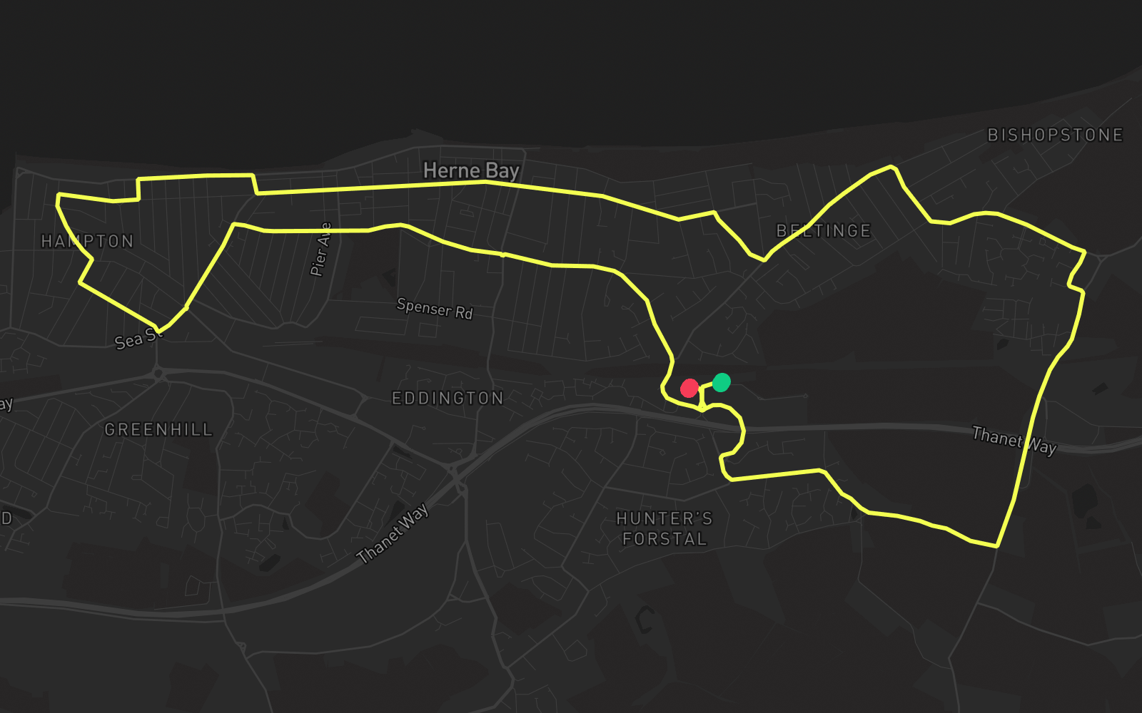
Route 4
Route 4 is one of the practice routes used by DVSA examiners at Herne Bay in Kent (CT6 6GZ). The route covers approximately 8.7 mi and typically takes 30 min. You'll encounter 8 roundabouts along the way. Use the Rodic app to simulate or drive this route with live GPS navigation.
Turn-by-turn instructions
26 stepsStart - The Boulevard
Start
Roundabout, take the first exit
Roundabout
Roundabout, take the third exit onto Margate Road
Roundabout
Roundabout, take the second exit onto King's Road
Roundabout
Turn LEFT onto Sea Street
Turn Left
Roundabout, take the second exit onto Sea Street
Roundabout
Turn RIGHT onto Clarendon Street
Turn Right
Turn RIGHT onto Sunnyhill Road
Turn Right
Turn LEFT onto Grand Drive
Turn Left
Turn RIGHT onto The Broadway
Turn Right
Turn LEFT onto Queensbridge Drive
Turn Left
Turn RIGHT onto Western Esplanade
Turn Right
Turn RIGHT onto Lane End
Turn Right
Turn LEFT onto Avenue Road
Turn Left
Turn RIGHT onto Sea View Road
Turn Right
Turn LEFT onto Reculver Road
Turn Left
Roundabout, take the second exit onto Reculver Road
Roundabout
Turn RIGHT onto Barnes Way
Turn Right
Turn LEFT onto Neville Road
Turn Left
Turn RIGHT onto Sweechbridge Road
Turn Right
Turn RIGHT onto Margate Road
Turn Right
Turn RIGHT onto Margate Road
Turn Right
Roundabout, take the second exit
Roundabout
Roundabout, take the third exit
Roundabout
Roundabout, take the first exit
Roundabout
Arrive
Destination