Practice this route
Simulate turn-by-turn navigation from anywhere, or drive it for real near the test centre.
Open in Rodic AppMore at Oxford
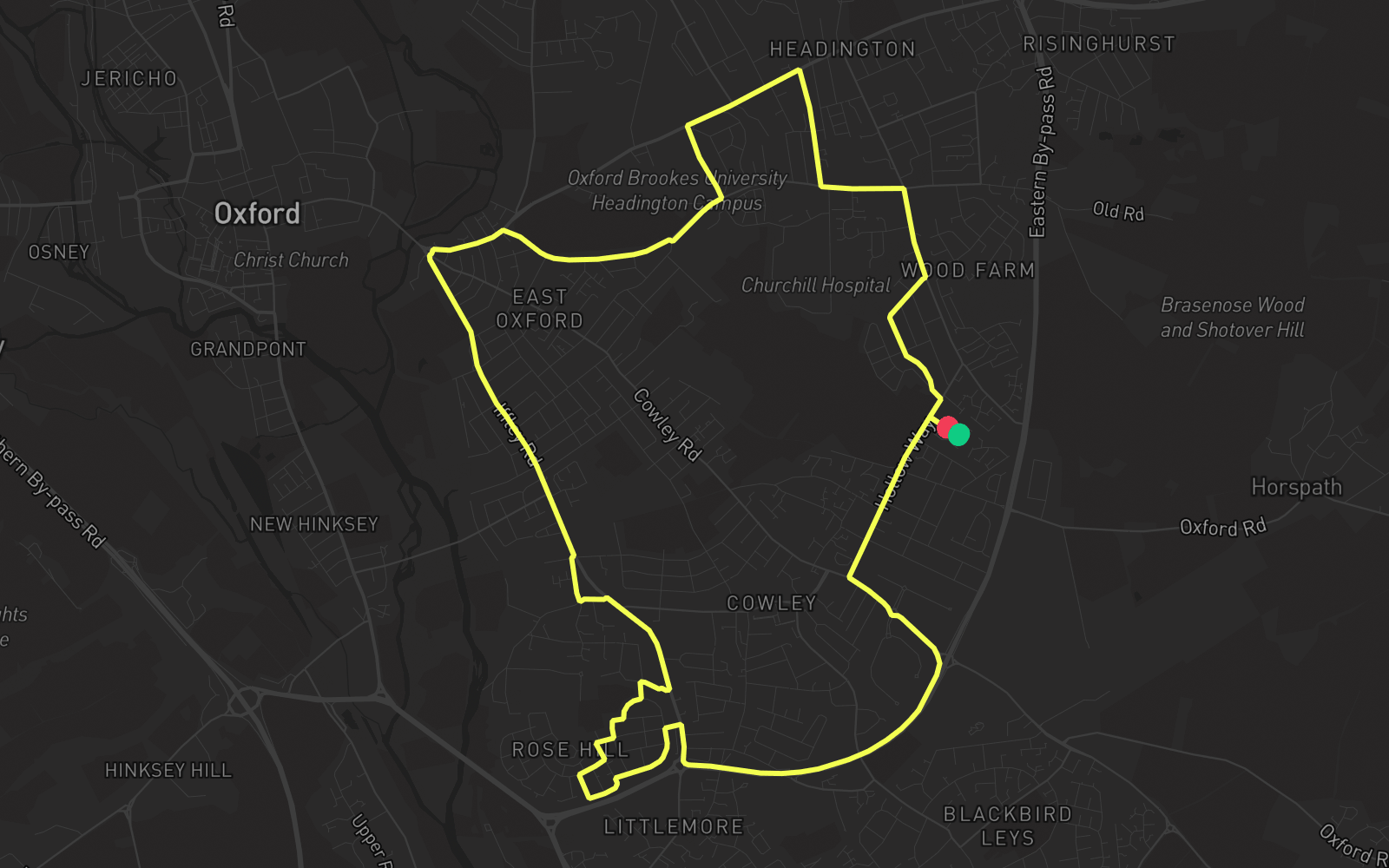
Route 4
Route 4 is one of the practice routes used by DVSA examiners at Oxford in Oxfordshire (OX4 2PY). The route covers approximately 8.9 mi and typically takes 30 min. You'll encounter 5 roundabouts along the way. Use the Rodic app to simulate or drive this route with live GPS navigation.
Turn-by-turn instructions
30 stepsStart - James Wolfe Road
Start
Turn RIGHT onto Hollow Way
Turn Right
Turn LEFT onto Dene Road
Turn Left
Turn RIGHT onto The Slade
Turn Right
Turn LEFT onto Old Road
Turn Left
Turn RIGHT onto Lime Walk
Turn Right
Turn LEFT onto London Road
Turn Left
Turn LEFT onto Gipsy Lane
Turn Left
Turn RIGHT onto Warneford Lane
Turn Right
Roundabout, take the second exit onto Morrell Avenue
Roundabout
Turn LEFT onto St Clements Street
Turn Left
Roundabout, take the second exit onto Iffley Road
Roundabout
Turn RIGHT onto Iffley Turn
Turn Right
Turn RIGHT onto Henley Avenue
Turn Right
Turn RIGHT onto Courtland Road
Turn Right
Turn LEFT onto Rowney Place
Turn Left
Turn RIGHT onto Spencer Crescent
Turn Right
Turn RIGHT onto Dashwood Road
Turn Right
Turn RIGHT onto Ashhurst Way
Turn Right
Turn LEFT onto Lambourn Road
Turn Left
Turn LEFT onto Asquith Road
Turn Left
Turn RIGHT onto Ashhurst Way
Turn Right
Turn RIGHT onto Oxford Road
Turn Right
Roundabout, take the first exit onto Eastern By-pass Road
Roundabout
Turn LEFT onto
Turn Left
Roundabout, take the first exit onto B480
Roundabout
Roundabout, take the second exit onto Garsington Road
Roundabout
Turn RIGHT onto Hollow Way
Turn Right
Turn RIGHT onto James Wolfe Road
Turn Right
Arrive - James Wolfe Road
Destination