Practice this route
Simulate turn-by-turn navigation from anywhere, or drive it for real near the test centre.
Open in Rodic AppMore at Pinner
Route 4
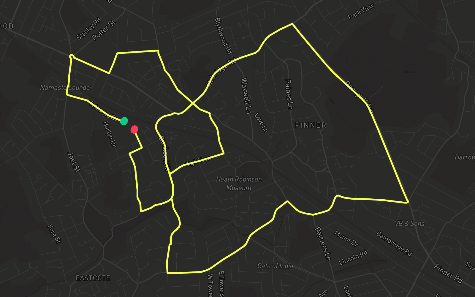
Route 4 is one of the practice routes used by DVSA examiners at Pinner in Greater London (HA5 2DZ). The route covers approximately 8.0 mi and typically takes 25 min. You'll encounter 2 roundabouts along the way. Use the Rodic app to simulate or drive this route with live GPS navigation.
Turn-by-turn instructions
23 stepsStart - Tolcarne Drive
Start
Turn RIGHT onto Joel Street
Turn Right
Roundabout, take the fourth exit onto Pinner Road
Roundabout
Turn LEFT onto Alandale Drive
Turn Left
Turn RIGHT onto Lyndhurst Avenue
Turn Right
Turn RIGHT onto Pinner Hill Road
Turn Right
Turn RIGHT onto Pinner Green
Turn Right
Turn LEFT onto Cuckoo Hill
Turn Left
Turn LEFT onto Cheney Street
Turn Left
Turn RIGHT onto Chiltern Road
Turn Right
Turn LEFT onto Cheney Street
Turn Left
Turn LEFT onto Bridle Road
Turn Left
Turn RIGHT onto Marsh Road
Turn Right
Turn LEFT onto George V Avenue
Turn Left
Roundabout, take the first exit onto Uxbridge Road
Roundabout
Turn LEFT onto Elm Park Road
Turn Left
Turn RIGHT onto West End Lane
Turn Right
Turn RIGHT onto High View
Turn Right
Turn LEFT onto Cuckoo Hill
Turn Left
Turn RIGHT onto Catlin's Lane
Turn Right
Turn RIGHT onto Chamberlain Way
Turn Right
Turn LEFT onto Tolcarne Drive
Turn Left
Arrive - Tolcarne Drive
Destination