Practice this route
Simulate turn-by-turn navigation from anywhere, or drive it for real near the test centre.
Open in Rodic AppMore at Wakefield
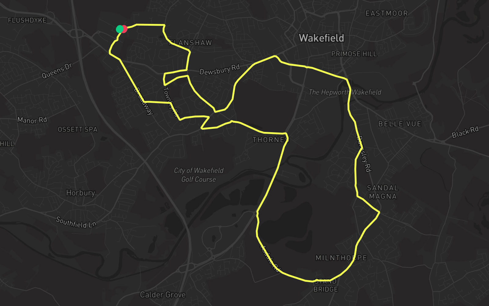
Route 4
Route 4 is one of the practice routes used by DVSA examiners at Wakefield in West Yorkshire (WF5 9TR). The route covers approximately 10.6 mi and typically takes 35 min. You'll encounter 5 roundabouts along the way. Use the Rodic app to simulate or drive this route with live GPS navigation.
Turn-by-turn instructions
29 stepsStart - The Wilfred
Start
Turn RIGHT onto Albert Drive
Turn Right
Roundabout, take the second exit onto Albert Drive
Roundabout
Turn LEFT onto Wakefield Road
Turn Left
Turn RIGHT onto Broadway
Turn Right
Turn LEFT onto Waterton Road
Turn Left
Turn RIGHT onto Townley Road
Turn Right
Turn LEFT onto Whinney Moor Avenue
Turn Left
Turn RIGHT onto Horbury Road
Turn Right
Turn LEFT onto Thornes Road
Turn Left
Turn RIGHT onto Thornes Road
Turn Right
Turn RIGHT onto A636
Turn Right
Turn RIGHT onto Denby Dale Road
Turn Right
Roundabout, take the second exit onto Asdale Road
Roundabout
Roundabout, take the first exit onto Standbridge Lane
Roundabout
Roundabout, take the second exit onto Standbridge Lane
Roundabout
Turn LEFT onto Castle Road
Turn Left
Turn RIGHT onto Manygates Lane
Turn Right
Turn LEFT onto Barnsley Road
Turn Left
Turn LEFT onto A638
Turn Left
Roundabout, take the second exit onto Ings Road
Roundabout
Turn LEFT onto Ings Road
Turn Left
Turn RIGHT onto George A Green Road
Turn Right
Turn LEFT onto Haselden Road
Turn Left
Turn RIGHT onto Townley Road
Turn Right
Turn RIGHT onto Dewsbury Road
Turn Right
Turn LEFT onto Flanshaw Lane
Turn Left
Turn LEFT onto Flanshaw Way
Turn Left
Arrive - Flanshaw Way
Destination