Practice this route
Simulate turn-by-turn navigation from anywhere, or drive it for real near the test centre.
Open in Rodic AppMore at Wolverhampton
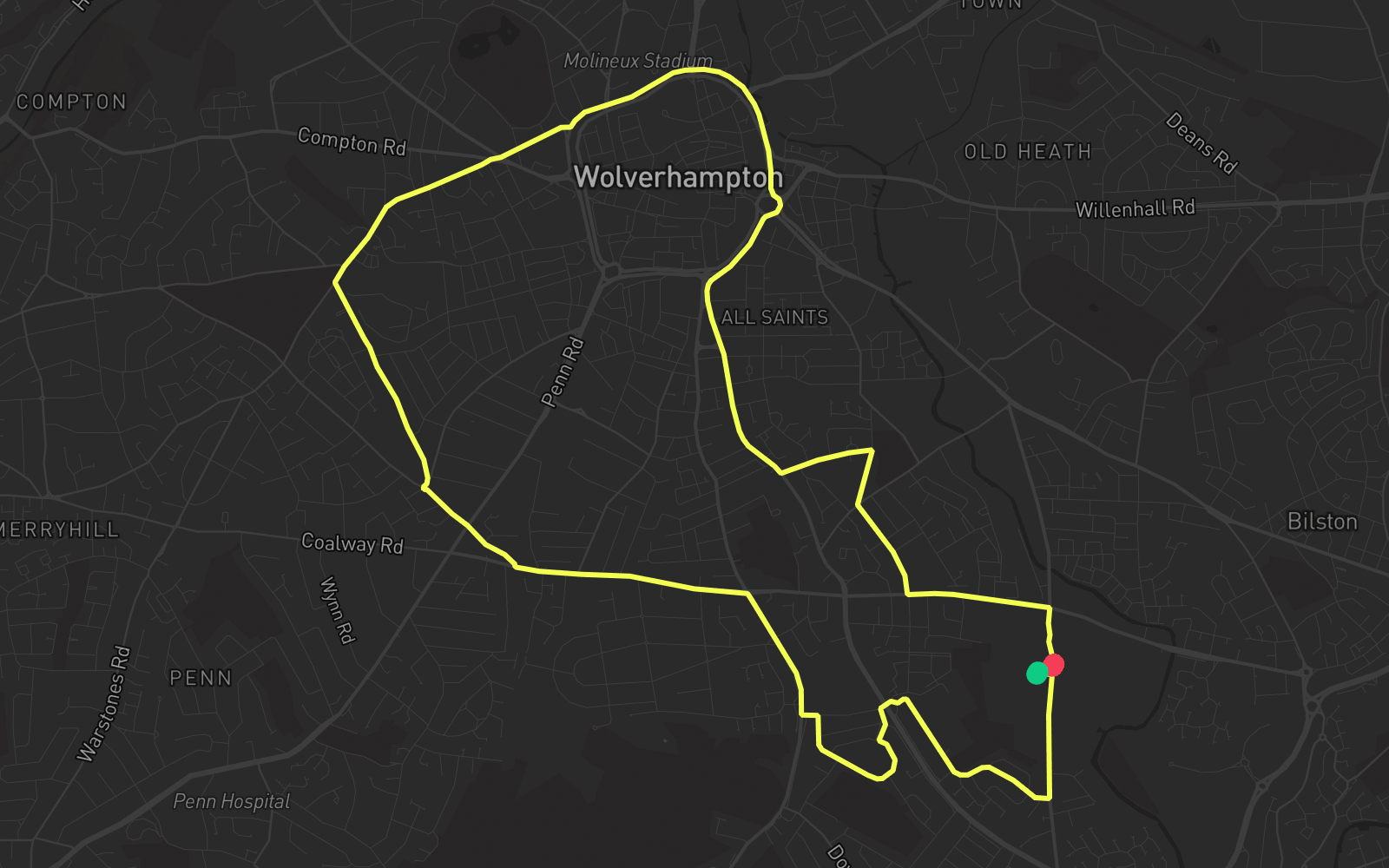
Route 1
Route 1 is one of the practice routes used by DVSA examiners at Wolverhampton in West Midlands (WV4 6JX). The route covers approximately 8.0 mi and typically takes 25 min. You'll encounter 3 roundabouts along the way. Use the Rodic app to simulate or drive this route with live GPS navigation.
Turn-by-turn instructions
29 stepsStart
Start
Turn RIGHT onto Spring Road
Turn Right
Turn RIGHT onto Hilton Road
Turn Right
Turn LEFT onto Walton Road
Turn Left
Turn LEFT onto Hateley Drive
Turn Left
Roundabout, take the second exit onto Hateley Drive
Roundabout
Turn LEFT onto Kenilworth Crescent
Turn Left
Turn LEFT onto Lawnswood Avenue
Turn Left
Turn RIGHT onto Wolverhampton Road East
Turn Right
Turn LEFT onto Goldthorn Hill Road
Turn Left
Turn RIGHT onto Rookery Lane
Turn Right
Turn RIGHT onto Stubbs Road
Turn Right
Roundabout, take the third exit onto Lea Road
Roundabout
Turn LEFT onto Jeffcock Road
Turn Left
Turn RIGHT onto Merridale Road
Turn Right
Continue on Compton Road
Continue
Turn LEFT onto Bath Road
Turn Left
Turn LEFT onto Ring Road St. Andrews
Turn Left
Turn RIGHT onto Ring Road St. Davids
Turn Right
Roundabout, take the third exit onto Ring Road St. George's
Roundabout
Turn LEFT onto Dudley Road
Turn Left
Turn LEFT onto Birmingham Road
Turn Left
Continue on Birmingham Road
Continue
Turn LEFT onto Silver Birch Road
Turn Left
Turn RIGHT onto Kent Road
Turn Right
Turn LEFT onto Myatt Avenue
Turn Left
Turn LEFT onto Parkfield Road
Turn Left
Turn RIGHT onto Manor Road
Turn Right
Arrive - Manor Road
Destination