Practice this route
Simulate turn-by-turn navigation from anywhere, or drive it for real near the test centre.
Open in Rodic AppMore at Yeovil
Route 2
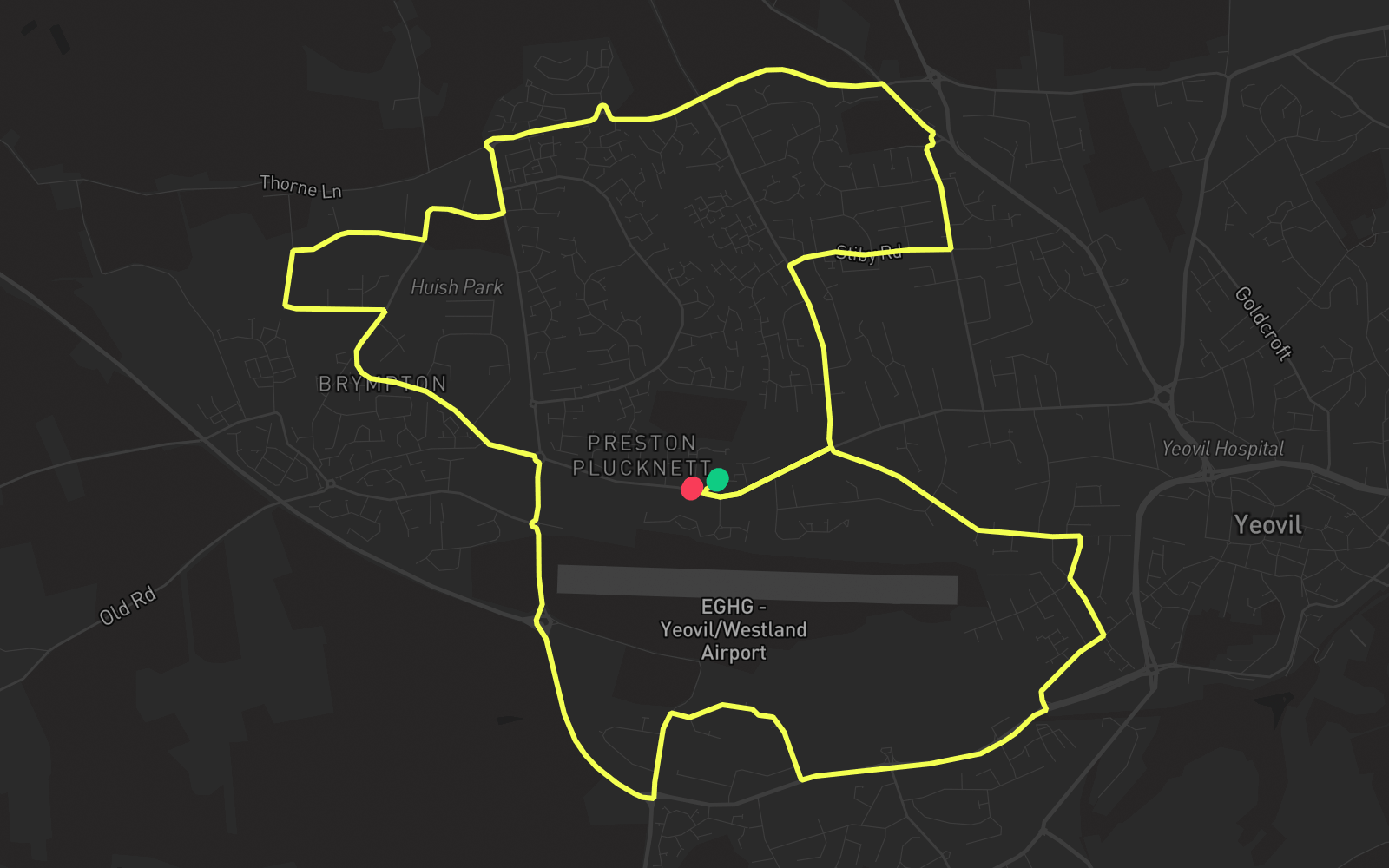
Route 2 is one of the practice routes used by DVSA examiners at Yeovil in Somerset (BA20 2EN). The route covers approximately 7.8 mi and typically takes 30 min. You'll encounter 5 roundabouts along the way. Use the Rodic app to simulate or drive this route with live GPS navigation.
Turn-by-turn instructions
30 stepsStart
Start
Turn LEFT onto Preston Road
Turn Left
Turn RIGHT onto Preston Grove
Turn Right
Turn RIGHT onto Orchard Street
Turn Right
Turn LEFT onto Beer Street
Turn Left
Turn RIGHT onto West Hendford
Turn Right
Turn RIGHT onto Lysander Road
Turn Right
Turn RIGHT onto Gazelle Road
Turn Right
Turn LEFT onto Watercombe Park
Turn Left
Turn LEFT onto Watercombe Lane
Turn Left
Turn RIGHT onto Western Relief Road
Turn Right
Roundabout, take the second exit onto Bunford Lane
Roundabout
Roundabout, take the second exit onto Bunford Lane
Roundabout
Roundabout, take the first exit onto Lufton Way
Roundabout
Turn LEFT onto Artillery Road
Turn Left
Turn RIGHT onto George Smith Way
Turn Right
Turn RIGHT onto Boundary Way
Turn Right
Turn LEFT onto Lufton Way
Turn Left
Turn RIGHT onto Copse Road
Turn Right
Turn LEFT onto Western Avenue
Turn Left
Roundabout, take the second exit onto Thorne Lane
Roundabout
Roundabout, take the fourth exit onto Thorne Lane
Roundabout
Turn RIGHT onto Tintinhull Road
Turn Right
Turn RIGHT onto
Turn Right
Turn LEFT onto
Turn Left
Turn RIGHT onto Coronation Avenue
Turn Right
Turn RIGHT onto Stiby Road
Turn Right
Turn LEFT onto Larkhill Road
Turn Left
Turn RIGHT onto Preston Road
Turn Right
Arrive - Preston Road
Destination